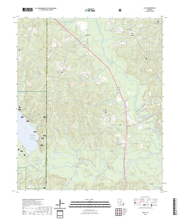
2024 Map of Lillie
USGS Topo · Published 2024About this map
Randolph and Lillie anchor this northern Louisiana corridor, where the land is defined by the winding paths of Corney Bayou and Little Cornie Bayou. The topography is marked by a high density of small family and community burial grounds, including Taylor-Hightower Cem and Spearsville Cem, which offer significant value for genealogical research in this rural borderland. To the southwest, a portion of the Kisatchie National Forest preserves the natural wooded character of the region, interspersed with local water features like Kidd Lake. The settlement pattern follows a network of parish roads connecting small centers such as Rum Center and Copley, while the drainage of Beaver Creek and Steep Bank Creek shapes the agricultural and timbered landscape between the Claiborne and Union Parish line.
Find a feature on this map
86 named features on this map. Tap any name to fly to it.
Don’t see what you’re looking for? This feature index may not catch every label — zoom into the map to look around manually.
Map Details
Editions of this 2024 Lillie Map
This is the sole edition of this map. No revisions or reprints were ever made.
Other maps of this area

1927 · El Dorado
USGS Topo · 1:62,500

1930 · El Dorado
USGS Topo · 1:62,500

1951 · Summerfield
USGS Topo · 1:62,500

1951 · Bernice
USGS Topo · 1:62,500

1951 · El Dorado
USGS Topo · 1:62,500

1953 · El Dorado
USGS Topo · 1:250,000

1955 · Shreveport
USGS Topo · 1:250,000

1956 · Shreveport
USGS Topo · 1:250,000

1957 · El Dorado
USGS Topo · 1:250,000

1958 · El Dorado
USGS Topo · 1:250,000