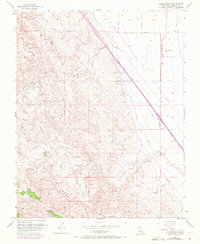
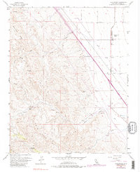
1956 Map of Lillis Ranch
USGS Topo · Published 1972About this map
Lillis Ranch and the Giffen Cantua Ranch anchor this West Side landscape, where the sharp transition from the valley floor to the base of the Blue Hills is meticulously mapped. The eastern portion of the sheet is defined by a rigid grid of agricultural roads, including Derrick Ave and Mt Whitney Ave, supporting a network of wells and a prominent Pipeline. This structured irrigation and transport system abruptly meets the natural drainage of Cantua Creek and Arroyo Hondo, which carve through the rising elevation of Monocline Ridge.
Find a feature on this map
22 named features on this map. Tap any name to fly to it.
Don’t see what you’re looking for? This feature index may not catch every label — zoom into the map to look around manually.
Map Details
Editions of this 1956 Lillis Ranch Map
5 editions found
Other maps of this area

1912 · Coalinga
USGS Topo · 1:125,000

1913 · Panoche
USGS Topo · 1:125,000

1915 · Priest Valley
USGS Topo · 1:125,000

1923 · Levis
USGS Topo · 1:31,680

1923 · Englebrecht Ranch
USGS Topo · 1:31,680

1923 · Monocline Ridge
USGS Topo · 1:31,680

1931 · Mouth of Cantua Creek
USGS Topo · 1:31,680

1943 · New Idria
USGS Topo · 1:62,500

1943 · Joaquin Rocks
USGS Topo · 1:62,500

1946 · Tranquillity
USGS Topo · 1:62,500