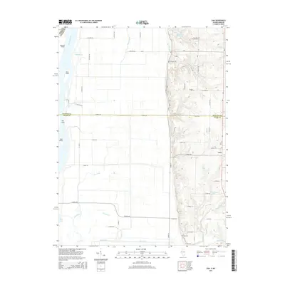
2015 Map of Lima
USGS Topo · Published 2015About this map
The Mississippi River forms the western boundary of this territory, where the floodplain is defined by an intricate network of waterways including Cutoff Slough, Taylor Slough, and Lima Slough. This low-lying bottomland is dotted with named landmasses like Buzzard Island and Hunt Island, separated from the mainland by the Bluff Canal. To the east, the terrain rises sharply into the bluffs, where the settlement of Lima is situated.
Find a feature on this map
63 named features on this map. Tap any name to fly to it.
Don’t see what you’re looking for? This feature index may not catch every label — zoom into the map to look around manually.
Map Details
Editions of this 2015 Lima Map
This is the sole edition of this map. No revisions or reprints were ever made.
Other maps of this area

1903 · Kahoka
USGS Topo · 1:125,000

1936 · Keokuk
USGS Topo · 1:62,500

1946 · Mendon
USGS Topo · 1:62,500

1948 · Mendon
USGS Topo · 1:62,500

1949 · Kahoka SE
USGS Topo · 1:24,000

1950 · Kahoka SE
USGS Topo · 1:24,000

1950 · Keokuk
USGS Topo · 1:62,500

1950 · La Grange
USGS Topo · 1:24,000

1950 · Canton
USGS Topo · 1:24,000
1951 · Canton
USGS Topo · 1:24,000