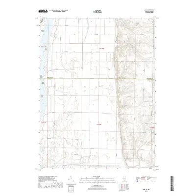
2018 Map of Lima
USGS Topo · Published 2018About this map
The Mississippi River and its complex system of chutes and sloughs define the western edge of this landscape at the border of Illinois and Missouri. The settlement of Lima serves as the inland hub, situated on higher ground east of the river’s bottomlands and the Bluff Canal. This 2018 survey reveals a terrain shaped by water management and drainage, where features like Steepage Ditch, Lima Slough, and Taylor Slough crisscross the low-lying agricultural fields. For those tracing local history, several distinct burial grounds are noted on the bluffs and ridges, including Lima Cem, Fletcher Cem, and Oak Valley Missionary Cem. The transition from the flat river valley to the dissected uplands is marked by numerous small water bodies such as Sill Lake, Scheuermann Lake, and the Jennifer Cr Reservoir, which gather water from the drainages of Shipe Cr and Jennifer Cr.
Find a feature on this map
65 named features on this map. Tap any name to fly to it.
Don’t see what you’re looking for? This feature index may not catch every label — zoom into the map to look around manually.
Map Details
Editions of this 2018 Lima Map
This is the sole edition of this map. No revisions or reprints were ever made.
Other maps of this area

1903 · Kahoka
USGS Topo · 1:125,000

1936 · Keokuk
USGS Topo · 1:62,500

1946 · Mendon
USGS Topo · 1:62,500

1948 · Mendon
USGS Topo · 1:62,500

1949 · Kahoka SE
USGS Topo · 1:24,000

1950 · Kahoka SE
USGS Topo · 1:24,000

1950 · Keokuk
USGS Topo · 1:62,500

1950 · La Grange
USGS Topo · 1:24,000

1950 · Canton
USGS Topo · 1:24,000
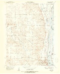
1951 · Canton
USGS Topo · 1:24,000