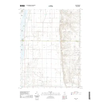
2021 Map of Lima
USGS Topo · Published 2021About this map
The Mississippi River bottomlands and the rising bluffs of Adams Co define this landscape along the Illinois and Missouri border. The settlement of Lima serves as a focal point on the higher ground to the east, where the terrain shifts from the flat, drainage-dependent agriculture of the river valley to a more dissected upland. This transition is marked by the Bluff Canal and Steepage Ditch, engineering features designed to manage the hydrology of the low-lying fields.
Find a feature on this map
72 named features on this map. Tap any name to fly to it.
Don’t see what you’re looking for? This feature index may not catch every label — zoom into the map to look around manually.
Map Details
Editions of this 2021 Lima Map
This is the sole edition of this map. No revisions or reprints were ever made.
Other maps of this area

1903 · Kahoka
USGS Topo · 1:125,000

1936 · Keokuk
USGS Topo · 1:62,500

1946 · Mendon
USGS Topo · 1:62,500

1948 · Mendon
USGS Topo · 1:62,500

1949 · Kahoka SE
USGS Topo · 1:24,000

1950 · Kahoka SE
USGS Topo · 1:24,000

1950 · Keokuk
USGS Topo · 1:62,500

1950 · La Grange
USGS Topo · 1:24,000

1950 · Canton
USGS Topo · 1:24,000
1951 · Canton
USGS Topo · 1:24,000