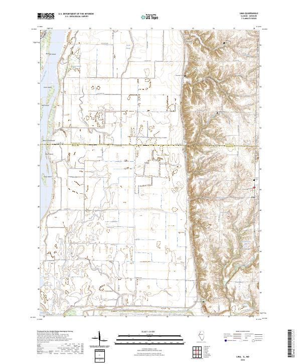
2024 Map of Lima
USGS Topo · Published 2024About this map
Mississippi River floodplains and the high bluffs of the Hancock and Adams County line define this western Illinois landscape. The small settlement of Lima serves as the primary hub, situated near the edge of a dissected plateau where numerous creeks like Snipe Creek and Petit Creek have carved deep valleys into the terrain. The bottomlands to the west are a complex network of wetlands and secondary channels, including Cutoff Slough and Taylor Slough, alongside a series of named islands such as Buzzard Island and Blue Goose Island.
Find a feature on this map
74 named features on this map. Tap any name to fly to it.
Don’t see what you’re looking for? This feature index may not catch every label — zoom into the map to look around manually.
Map Details
Editions of this 2024 Lima Map
This is the sole edition of this map. No revisions or reprints were ever made.
Other maps of this area

1903 · Kahoka
USGS Topo · 1:125,000

1936 · Keokuk
USGS Topo · 1:62,500

1946 · Mendon
USGS Topo · 1:62,500

1948 · Mendon
USGS Topo · 1:62,500

1949 · Kahoka SE
USGS Topo · 1:24,000

1950 · Kahoka SE
USGS Topo · 1:24,000

1950 · Keokuk
USGS Topo · 1:62,500

1950 · La Grange
USGS Topo · 1:24,000

1950 · Canton
USGS Topo · 1:24,000
1951 · Canton
USGS Topo · 1:24,000