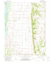
1981 Map of Lima
USGS Topo · Published 1981About this map
The Mississippi River defines the western edge of this landscape, its path punctuated by large river features like Buzzard Island, Hunt Island, and Blue Goose Island. To the east, the terrain rises sharply from the river bottoms into the wooded bluffs of Lima and Ursa townships. The settlement of Lima sits on this higher ground, serving as a hub for the surrounding agricultural community. The map reveals a transition from the intensive drainage systems of the bottomlands—marked by the Lima Slough and various pumping stations—to the dissected upland creeks like Petit Creek and Shipe Creek. Genealogists will find several burial grounds preserved here, including Fletcher Cem, Gallimore Cem, and Crenshaw Cem, often situated near the bluff line or along the winding creek branches. Evidence of local industry appears in the form of several quarries tucked into the hillsides, while the McAllister Landing Strip and Meeker Landing Strip represent the era's local aviation infrastructure.
Find a feature on this map
31 named features on this map. Tap any name to fly to it.
Don’t see what you’re looking for? This feature index may not catch every label — zoom into the map to look around manually.
Map Details
Editions of this 1981 Lima Map
This is the sole edition of this map. No revisions or reprints were ever made.
Other maps of this area

1903 · Kahoka
USGS Topo · 1:125,000

1936 · Keokuk
USGS Topo · 1:62,500

1946 · Mendon
USGS Topo · 1:62,500

1948 · Mendon
USGS Topo · 1:62,500

1949 · Kahoka SE
USGS Topo · 1:24,000

1950 · Kahoka SE
USGS Topo · 1:24,000

1950 · Keokuk
USGS Topo · 1:62,500

1950 · La Grange
USGS Topo · 1:24,000

1950 · Canton
USGS Topo · 1:24,000
1951 · Canton
USGS Topo · 1:24,000