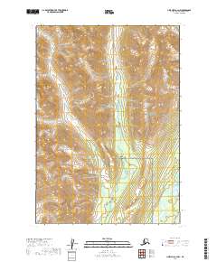
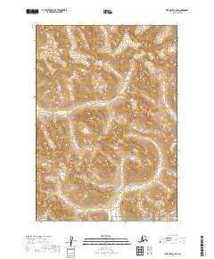
2019 Map of Lime Hills A-3 NW
USGS Topo · Published 2019About this map
Lake Clark National Preserve defines much of this interior Alaskan landscape, where the high ridges of the Lime Hills descend toward the valley floor. The geography is dominated by the glacial drainage of Kristin Creek, which winds southward through complex wetlands and braided channels before meeting the Stony River in the southeast corner. This 2019 survey illustrates the dramatic elevation changes characteristic of the region, showing how the river systems navigate the base of steep topographic features. The map provides a detailed view of the natural boundaries where the preserve intersects with various township and range lines, including t13n r27w and t12n r26w, marking a transition from high-altitude slopes to the shifting riverine environments below.
Find a feature on this map
7 named features on this map. Tap any name to fly to it.
Don’t see what you’re looking for? This feature index may not catch every label — zoom into the map to look around manually.
Map Details
Editions of this 2019 Lime Hills A-3 NW Map
This is the sole edition of this map. No revisions or reprints were ever made.
Other maps of this area

1951 · Lime Hills
USGS Topo · 1:250,000

1954 · Lime Hills A-3
USGS Topo · 1:63,360

1954 · Lime Hills B-4
USGS Topo · 1:63,360

1954 · Lime Hills A-4
USGS Topo · 1:63,360

1954 · Lime Hills B-3
USGS Topo · 1:63,360

1958 · Lime Hills
USGS Topo · 1:250,000
2019 · Lime Hills A-3 SW
USGS Topo · 1:25,000
2019 · Lime Hills A-3 SE
USGS Topo · 1:25,000
2019 · Lime Hills A-3 NE
USGS Topo · 1:25,000
2019 · Lime Hills B-3 SW
USGS Topo · 1:25,000