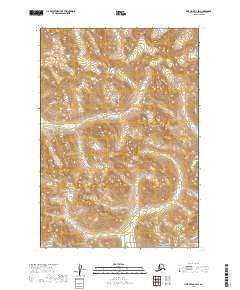
2019 Map of Lime Hills B-3 SW
USGS Topo · Published 2019About this map
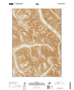
Lake Clark National Preserve encompasses the southern portion of this landscape, marking a transition from the higher alpine reaches of the Bethel Census Area to the protected wilderness of the preserve. The terrain is defined by a series of steep, unnamed ridges and drainages typical of the Alaska Range, where the high-altitude hydrology is primarily captured by the course of Kristin Cr flowing through the southern valley. The topographic data, derived from the National Elevation Dataset, highlights the isolation of this region within the t14n r27w and t13n r26w townships. There are no roads or modern structures recorded on this sheet, reflecting a primitive wilderness state where the only named natural landmark is the creek winding through the preserve's northern boundary.
Find a feature on this map
8 named features on this map. Tap any name to fly to it.
Don’t see what you’re looking for? This feature index may not catch every label — zoom into the map to look around manually.
Map Details
Editions of this 2019 Lime Hills B-3 SW Map
This is the sole edition of this map. No revisions or reprints were ever made.
Other maps of this area

1951 · Lime Hills
USGS Topo · 1:250,000

1954 · Lime Hills A-3
USGS Topo · 1:63,360

1954 · Lime Hills B-4
USGS Topo · 1:63,360

1954 · Lime Hills A-4
USGS Topo · 1:63,360

1954 · Lime Hills B-3
USGS Topo · 1:63,360

1958 · Lime Hills
USGS Topo · 1:250,000
2019 · Lime Hills A-3 NW
USGS Topo · 1:25,000
2019 · Lime Hills B-3 NW
USGS Topo · 1:25,000
2019 · Lime Hills A-3 NE
USGS Topo · 1:25,000
2019 · Lime Hills B-4 SE
USGS Topo · 1:25,000