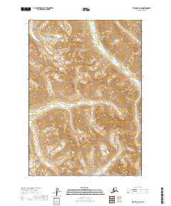
2019 Map of Lime Hills B-4 SE
USGS Topo · Published 2019About this map
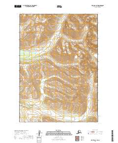
High-elevation terrain dominates this 2019 survey of the Lime Hills B-4 SE quadrangle in the Bethel Census Area. The topography is defined by significant vertical relief across multiple townships, including t15n r28w and t14n r27w. The only named hydrological feature on the sheet is Rock Cr, which flows through the southeastern portion of the map within t13n r27w. This landscape is primarily comprised of unnamed ridges and valleys, with contour lines indicating a complex network of high summits and drainage basins characteristic of the interior Alaskan wilderness. Given the absence of roads, trails, or structures, the map provides a foundational record of the natural landforms and the established Public Land Survey System grid lines that divide this undeveloped region.
Find a feature on this map
7 named features on this map. Tap any name to fly to it.
Don’t see what you’re looking for? This feature index may not catch every label — zoom into the map to look around manually.
Map Details
Editions of this 2019 Lime Hills B-4 SE Map
This is the sole edition of this map. No revisions or reprints were ever made.
Other maps of this area

1951 · Lime Hills
USGS Topo · 1:250,000

1954 · Lime Hills A-3
USGS Topo · 1:63,360

1954 · Lime Hills B-4
USGS Topo · 1:63,360

1954 · Lime Hills A-4
USGS Topo · 1:63,360

1954 · Lime Hills B-3
USGS Topo · 1:63,360

1958 · Lime Hills
USGS Topo · 1:250,000
2019 · Lime Hills A-3 NW
USGS Topo · 1:25,000
2019 · Lime Hills B-3 NW
USGS Topo · 1:25,000
2019 · Lime Hills B-3 SW
USGS Topo · 1:25,000
2019 · Lime Hills A-4 NE
USGS Topo · 1:25,000