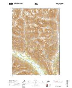
2019 Map of Lime Hills B-1 NE
USGS Topo · Published 2019About this map
Lake Clark National Park dominates the interior of this 2019 survey, showcasing a landscape defined by glacial hydrology and extreme relief. The boundary between the Bethel Census Area and the Kenai Peninsula Borough bisects the terrain, marking a political division across a wilderness of high peaks and alpine basins. Water drainage is the primary topographical feature, with the Chilligan River flowing through the southern valleys and the Styx River appearing in the northwest corner. This map serves as a contemporary record of the shifting hydrological patterns within protected federal lands, illustrating the complex network of unnamed streams and wetlands that feed these major river systems.
Find a feature on this map
8 named features on this map. Tap any name to fly to it.
Don’t see what you’re looking for? This feature index may not catch every label — zoom into the map to look around manually.
Map Details
Editions of this 2019 Lime Hills B-1 NE Map
This is the sole edition of this map. No revisions or reprints were ever made.
Other maps of this area

1949 · Tyonek
USGS Topo · 1:250,000

1951 · Tyonek
USGS Topo · 1:250,000

1951 · Lime Hills
USGS Topo · 1:250,000

1958 · Tyonek B-8
USGS Topo · 1:63,360

1958 · Tyonek C-8
USGS Topo · 1:63,360

1958 · Tyonek
USGS Topo · 1:250,000

1958 · Lime Hills B-1
USGS Topo · 1:63,360

1958 · Lime Hills C-1
USGS Topo · 1:63,360

1958 · Lime Hills
USGS Topo · 1:250,000

1965 · Tyonek
USGS Topo · 1:250,000