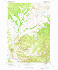
1962 Map of Lincoln Gulch
USGS Topo · Published 1974About this map
The Deerlodge National Forest and Beaverhead National Forest meet in this high-altitude ranching and recreation landscape, documented during a 1962 field check. A distinct pattern of family-owned ranching operations follows the drainage basins, with properties like the Home Ranch and Ralston Ranch established near the transition from valley floors to the timbered uplands. The rugged geography is defined by a dense network of numbered and named drainages, including the aptly named Slaughterhouse Creek and First Chance Creek. In the southwest corner, the Big Hole River cuts through the terrain near the Deep Creek Ski Area, illustrating the dual identity of the region as both a working landscape and a burgeoning destination for outdoor recreation during the mid-twentieth century.
Find a feature on this map
81 named features on this map. Tap any name to fly to it.
Don’t see what you’re looking for? This feature index may not catch every label — zoom into the map to look around manually.
Map Details
Editions of this 1962 Lincoln Gulch Map
3 editions found

Other maps of this area

1889 · Helena
USGS Topo · 1:250,000

1893 · Helena
USGS Topo · 1:250,000

1893 · Dillon
USGS Topo · 1:250,000

1899 · Helena
USGS Topo · 1:250,000

1903 · Helena
USGS Topo · 1:250,000

1908 · Philipsburg
USGS Topo · 1:125,000

1947 · Butte
USGS Topo · 1:250,000

1955 · Dillon
USGS Topo · 1:250,000

1957 · Dillon
USGS Topo · 1:250,000

1958 · Butte
USGS Topo · 1:250,000