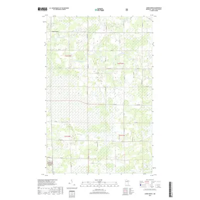
2019 Map of Linden Grove
USGS Topo · Published 2019About this map
Linden Grove anchors the northwest corner of this northern Minnesota landscape, where the Little Fork River meanders through a dense network of wetlands and wooded terrain. The area is defined by its significant watercourses, including the Rice River and Flint Cr, which cut through the low-lying topography of Saint Louis County. Navigational landmarks like Durant Rapids and Tuttle Rapids along the river suggest the varied flow of these northern waters, which drain toward the Rainy River basin.
Find a feature on this map
26 named features on this map. Tap any name to fly to it.
Don’t see what you’re looking for? This feature index may not catch every label — zoom into the map to look around manually.
Map Details
Editions of this 2019 Linden Grove Map
This is the sole edition of this map. No revisions or reprints were ever made.
Other maps of this area

1952 · Idington
USGS Topo · 1:24,000

1954 · Hibbing
USGS Topo · 1:250,000

1955 · Dark Lake
USGS Topo · 1:24,000

1955 · Dewey Lake NW
USGS Topo · 1:24,000

1957 · Hibbing
USGS Topo · 1:250,000

1958 · Hibbing
USGS Topo · 1:250,000

1964 · Hibbing
USGS Topo · 1:250,000

1964 · Linden Grove
USGS Topo · 1:24,000

1964 · Haley
USGS Topo · 1:24,000

1964 · Gheen NW
USGS Topo · 1:24,000