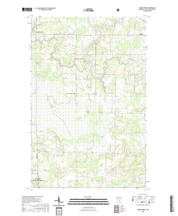
2022 Map of Linden Grove
USGS Topo · Published 2022About this map
The northern reaches of Linden Grove anchor a landscape defined by an intricate network of waterways and the conservation boundaries of the Superior National Forest. This terrain is dominated by the meandering course of the Little Fork River and its numerous tributaries, including Flint Cr and Alango Cr. The drainage patterns suggest a low-lying, seasonally wet environment where human settlement is scattered and secondary to the natural hydrography. The southern portion of the area is increasingly dominated by the forest reservation, where the grid of sections gives way to protected timberlands.
Find a feature on this map
25 named features on this map. Tap any name to fly to it.
Don’t see what you’re looking for? This feature index may not catch every label — zoom into the map to look around manually.
Map Details
Editions of this 2022 Linden Grove Map
This is the sole edition of this map. No revisions or reprints were ever made.
Other maps of this area

1952 · Idington
USGS Topo · 1:24,000

1954 · Hibbing
USGS Topo · 1:250,000

1955 · Dark Lake
USGS Topo · 1:24,000

1955 · Dewey Lake NW
USGS Topo · 1:24,000

1957 · Hibbing
USGS Topo · 1:250,000

1958 · Hibbing
USGS Topo · 1:250,000

1964 · Hibbing
USGS Topo · 1:250,000

1964 · Linden Grove
USGS Topo · 1:24,000

1964 · Haley
USGS Topo · 1:24,000

1964 · Gheen NW
USGS Topo · 1:24,000