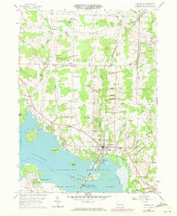
1959 Map of Linesville
USGS Topo · Published 1972About this map
Linesville serves as the focal point of this western Crawford County survey, situated at the edge of the expansive Shenango River Pymatuning Reservoir. The landscape is defined by the intersection of water and infrastructure, with the Penn Central railroad and a significant Pipeline cutting through the rural townships. Local life is documented through numerous small cemeteries such as Baldwin Cem, Shaw Cem, and Frey Cem, alongside institutional landmarks like the Township Sch and Calvary Ch. The map highlights the area's transition into a recreational and conservation hub, noting Pymatuning State Park and the State Fish Hatchery, while Merrys Pymatuning Airport suggests the mid-century development of local aviation. The shoreline is intricately detailed, showing islands like Harris Island and Ford Island within the reservoir's reach.
Find a feature on this map
41 named features on this map. Tap any name to fly to it.
Don’t see what you’re looking for? This feature index may not catch every label — zoom into the map to look around manually.
Map Details
Editions of this 1959 Linesville Map
Other maps of this area

1900 · Girard
USGS Topo · 1:62,500

1905 · Andover
USGS Topo · 1:48,000

1906 · Conneaut
USGS Topo · 1:62,500

1906 · Linesville
USGS Topo · 1:62,500

1907 · Andover
USGS Topo · 1:62,500

1908 · Linesville
USGS Topo · 1:62,500

1950 · Cleveland
USGS Topo · 1:250,000

1956 · Cleveland
USGS Topo · 1:250,000

1959 · Conneautville
USGS Topo · 1:24,000

1959 · Hartstown
USGS Topo · 1:24,000
Featured Places
- Linesville, PA
- Summerhill Township, PA
- Pymatuning Central, PA
- Pine Township, PA
- Tuttle Lake, Pymatuning Central