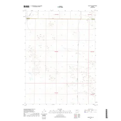
2017 Map of Linscott NW
USGS Topo · Published 2017About this map
The boundary between Blaine County and Custer County divides this high-plains landscape, where the topography is defined by the shifting forms of the Sandhills. The northern reaches are drained by the headwaters of Wild Horse Cr, which carves a path through the sand-dune complex in the northwest corner of the survey. Unlike the more densely settled river valleys, this area is characterized by an open, rural structure where transportation is limited to a few arterial routes such as Dunning Rd and Grandview Rd. The vast network of section lines and township boundaries, including t20n r25w and t19n r25w, underscores the systematic land division essential for ranching operations in this part of Nebraska.
Find a feature on this map
11 named features on this map. Tap any name to fly to it.
Don’t see what you’re looking for? This feature index may not catch every label — zoom into the map to look around manually.
Map Details
Editions of this 2017 Linscott NW Map
This is the sole edition of this map. No revisions or reprints were ever made.
Other maps of this area

1948 · Linscott
USGS Topo · 1:62,500

1948 · Halsey
USGS Topo · 1:62,500

1950 · Linscott
USGS Topo · 1:62,500

1950 · Halsey
USGS Topo · 1:62,500

1951 · Dunning
USGS Topo · 1:62,500

1951 · Hoagland
USGS Topo · 1:62,500

1954 · North Platte
USGS Topo · 1:250,000

1956 · North Platte
USGS Topo · 1:250,000

1957 · North Platte
USGS Topo · 1:250,000

1967 · North Platte
USGS Topo · 1:250,000