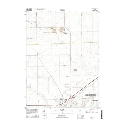
2015 Map of Lisbon
USGS Topo · Published 2015About this map
The town of Lisbon and the northern outskirts of Morris anchor this prairie landscape along the Kendall Co and Grundy Co line. This modern survey illustrates the persistent agricultural grid punctuated by small settlements like Central and Saratoga. A major industrial and historical corridor defines the southern portion of the map, where the Illinois and Michigan Canal National Heritage Corridor runs parallel to Interstate 80. Local history is well-preserved through numerous burial grounds, including the Munger Cem, Cryder Cem, and Catholic North Cem. The landscape also features significant water management and infrastructure, from the large Collins Cooling Pond to the Morris Municipal Airport - James R. Washburn Field, reflecting the transition from traditional farming to modern industrial and transportation utility.
Find a feature on this map
60 named features on this map. Tap any name to fly to it.
Don’t see what you’re looking for? This feature index may not catch every label — zoom into the map to look around manually.
Map Details
Editions of this 2015 Lisbon Map
This is the sole edition of this map. No revisions or reprints were ever made.
Other maps of this area

1892 · Morris
USGS Topo · 1:62,500

1892 · Marseilles
USGS Topo · 1:62,500

1916 · Marseilles
USGS Topo · 1:62,500

1918 · Morris
USGS Topo · 1:62,500

1925 · Yorkville
USGS Topo · 1:62,500

1940 · Marseilles
USGS Topo · 1:62,500

1948 · Sandwich
USGS Topo · 1:62,500

1950 · Sandwich
USGS Topo · 1:62,500

1953 · Morris
USGS Topo · 1:24,000

1953 · Plattville
USGS Topo · 1:24,000