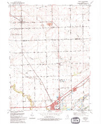
1993 Map of Lisbon
USGS Topo · Published 1994About this map
The agrarian expanse of Lisbon and Saratoga townships transitions into the northern industrial and municipal edge of Morris in this early 1990s record of Grundy and Kendall counties. While much of the land remains committed to cultivation, the presence of the Morris Municipal Airport, a prominent Radio Tower, and the County Fairground signals the area's role as a regional hub. Local history and genealogy are anchored by landmarks like Saratoga Cem, Grace Ch, and the Saratoga Sch Cem.
Find a feature on this map
35 named features on this map. Tap any name to fly to it.
Don’t see what you’re looking for? This feature index may not catch every label — zoom into the map to look around manually.
Map Details
Editions of this 1993 Lisbon Map
This is the sole edition of this map. No revisions or reprints were ever made.
Other maps of this area

1892 · Morris
USGS Topo · 1:62,500

1892 · Marseilles
USGS Topo · 1:62,500

1916 · Marseilles
USGS Topo · 1:62,500

1918 · Morris
USGS Topo · 1:62,500

1925 · Yorkville
USGS Topo · 1:62,500

1940 · Marseilles
USGS Topo · 1:62,500

1948 · Sandwich
USGS Topo · 1:62,500

1950 · Sandwich
USGS Topo · 1:62,500

1953 · Morris
USGS Topo · 1:24,000

1953 · Plattville
USGS Topo · 1:24,000