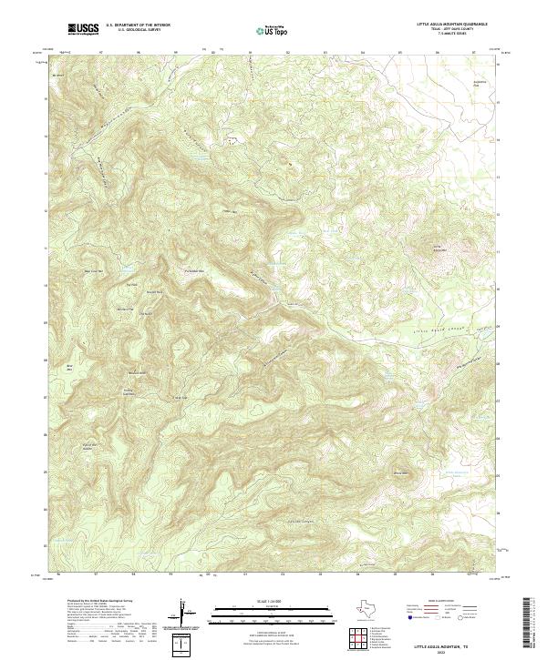
2022 Map of Little Aguja Mountain
USGS Topo · Published 2022About this map
Madera Springs Lodge stands near the confluence of canyon systems in this high-elevation Texas landscape. The intricate drainage network is defined by deep cuts such as Madera Canyon and Million Dollar Canyon, with essential water sources like Dark Canyon Spring and Airplane Tank Spring sustaining the area. Topographic landmarks such as Needle Rock, Eye of the Needle, and Balance Rock suggest a geologist’s or hiker’s destination, while Trickey Gap Park provides a central reference point for the surrounding peaks.
Find a feature on this map
43 named features on this map. Tap any name to fly to it.
Don’t see what you’re looking for? This feature index may not catch every label — zoom into the map to look around manually.
Map Details
Editions of this 2022 Little Aguja Mountain Map
This is the sole edition of this map. No revisions or reprints were ever made.
Other maps of this area

1894 · Valentine
USGS Topo · 1:125,000

1894 · Fort Davis
USGS Topo · 1:125,000

1897 · Valentine
USGS Topo · 1:125,000

1897 · Fort Davis
USGS Topo · 1:125,000

1943 · Valentine
USGS Topo · 1:125,000

1954 · Fort Stockton
USGS Topo · 1:250,000

1958 · Fort Stockton
USGS Topo · 1:250,000

1959 · Marfa
USGS Topo · 1:250,000

1965 · Marfa
USGS Topo · 1:250,000

1972 · Casket Mountain
USGS Topo · 1:24,000