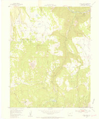
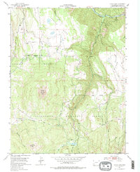
1953 Map of Little Cone
USGS Topo · Published 1955About this map
Little Cone dominates the high-altitude landscape of San Miguel County in this mid-century survey, standing as a prominent landmark within the Uncompahgre National Forest. The map documents a rugged transition between the high plateaus of Specie Mesa and Wilson Mesa, divided by the deep drainages of Specie Creek and Fall Creek. Water management for the high-country ranching and mining economy is evident through features like Hughes Ditch, which cuts across the steep contours above the San Miguel River.
Find a feature on this map
20 named features on this map. Tap any name to fly to it.
Don’t see what you’re looking for? This feature index may not catch every label — zoom into the map to look around manually.
Map Details
Editions of this 1953 Little Cone Map
6 editions found
Other maps of this area

1897 · Telluride
USGS Topo · 1:62,500

1904 · Telluride
USGS Topo · 1:62,500

1909 · Montrose
USGS Topo · 1:125,000

1911 · Montrose
USGS Topo · 1:125,000

1945 · Durango
USGS Topo · 1:250,000

1953 · Mount Wilson
USGS Topo · 1:24,000

1953 · Dolores Peak
USGS Topo · 1:24,000

1953 · Placerville
USGS Topo · 1:24,000
1953 · Gray Head
USGS Topo · 1:24,000

1953 · Little Cone
USGS Topo · 1:24,000