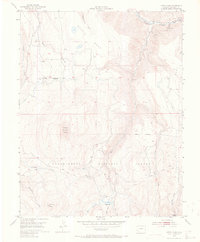
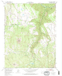
1953 Map of Little Cone
USGS Topo · Published 1970About this map
Specie Mesa and Wilson Mesa dominate this high-altitude landscape in San Miguel County, recorded during a 1952 aerial survey. The San Miguel River cuts through the northern boundary near the small settlement at Saw Pit, where the presence of a Gaging Sta and an aerial tramway nearby suggest the area's industrial and water-management activities. Much of the terrain lies within the Uncompahgre National Forest, characterized by steep drainage systems like Fall Creek and Specie Creek. The map documents early water infrastructure essential for high-country life, including Hughes Ditch and Wilson Ditch, which redirect snowmelt across the plateaus. For those tracking land use, the network of a Pack Trail and various unnamed trails winding toward Little Cone and Woods Lake provides a detailed look at the era's backcountry accessibility.
Find a feature on this map
22 named features on this map. Tap any name to fly to it.
Don’t see what you’re looking for? This feature index may not catch every label — zoom into the map to look around manually.
Map Details
Editions of this 1953 Little Cone Map
6 editions found
Other maps of this area

1897 · Telluride
USGS Topo · 1:62,500

1904 · Telluride
USGS Topo · 1:62,500

1909 · Montrose
USGS Topo · 1:125,000

1911 · Montrose
USGS Topo · 1:125,000

1945 · Durango
USGS Topo · 1:250,000

1953 · Mount Wilson
USGS Topo · 1:24,000

1953 · Dolores Peak
USGS Topo · 1:24,000

1953 · Placerville
USGS Topo · 1:24,000
1953 · Gray Head
USGS Topo · 1:24,000

1953 · Little Cone
USGS Topo · 1:24,000