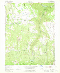
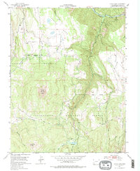
1953 Map of Little Cone
USGS Topo · Published 1965About this map
The high alpine country of San Miguel County is dominated by the prominent peaks of Little Cone and Flat Top Peak, providing a detailed view of the rugged Colorado landscape in the early 1950s. The northern edge of the map follows the course of the San Miguel River, where the industrial activity at Saw Pit marks a hub of early regional development. This survey, conducted in cooperation with the United States Atomic Energy Commission, highlights a landscape of significant elevation changes and water management, evidenced by features like Hughes Ditch and the Hughes Trail traversing Specie Mesa. Within the Uncompahgre National Forest, the map records numerous watercourses such as Fall Creek and Wilson Creek as they drain toward the canyon, alongside Woods Lake in the southern high country. The inclusion of a Gaging Sta and varied pack trails suggests the importance of water resource monitoring and remote access during this era of uranium-focused exploration.
Find a feature on this map
23 named features on this map. Tap any name to fly to it.
Don’t see what you’re looking for? This feature index may not catch every label — zoom into the map to look around manually.
Map Details
Editions of this 1953 Little Cone Map
6 editions found
Other maps of this area

1897 · Telluride
USGS Topo · 1:62,500

1904 · Telluride
USGS Topo · 1:62,500

1909 · Montrose
USGS Topo · 1:125,000

1911 · Montrose
USGS Topo · 1:125,000

1945 · Durango
USGS Topo · 1:250,000

1953 · Mount Wilson
USGS Topo · 1:24,000

1953 · Dolores Peak
USGS Topo · 1:24,000

1953 · Placerville
USGS Topo · 1:24,000
1953 · Gray Head
USGS Topo · 1:24,000

1953 · Little Cone
USGS Topo · 1:24,000