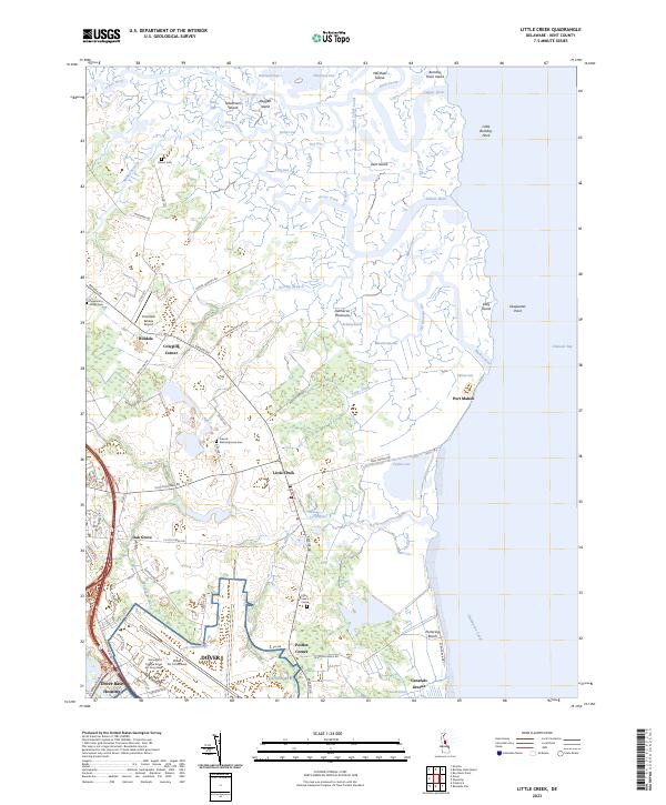
2023 Map of Little Creek
USGS Topo · Published 2023About this map
The Delmarva Peninsula coastline near Little Creek is defined by a complex network of tidal waterways and salt marshes. This modern survey illustrates the intersection of military infrastructure and historic coastal settlements, with the sprawling Dover Air Force Base and its Dover Base Housing complex dominating the southwestern quadrant. The geography is characterized by intricate water bodies such as the Leipsic River, Simons River, and Mahon River, which carve through low-lying terrain and islands like Kent Island and Bombay Hook Island.
Find a feature on this map
91 named features on this map. Tap any name to fly to it.
Don’t see what you’re looking for? This feature index may not catch every label — zoom into the map to look around manually.
Map Details
Editions of this 2023 Little Creek Map
This is the sole edition of this map. No revisions or reprints were ever made.
Historical Maps of Hilldale Through Time
4 maps found