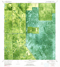
1974 Map of Little Cypress Swamp
USGS Topo · Published 1993About this map
Levee 3 cuts a diagonal line through this orthophotomap, marking the engineered landscape of south Florida during the 1970s. This survey, based on aerial photography from 1971, provides a detailed visual of the terrain along the boundary of Henry Co and Palm Beach Co. The imagery reveals a patchwork of land use where geometric drainage patterns and agricultural plots meet the natural textures of the Florida interior. Human presence is marked by a remote Landing Strip and a Deer Fence, indicating the specialized infrastructure of this rural region. The map captures a transition point where water management and private land lines shape the environment, providing a technical look at the land's modification decades before major contemporary changes reached this specific area.
Find a feature on this map
4 named features on this map. Tap any name to fly to it.
Don’t see what you’re looking for? This feature index may not catch every label — zoom into the map to look around manually.
Map Details
Editions of this 1974 Little Cypress Swamp Map
3 editions found
Other maps of this area

1956 · West Palm Beach
USGS Topo · 1:250,000

1957 · West Palm Beach
USGS Topo · 1:250,000

1958 · West Palm Beach
USGS Topo · 1:250,000

1970 · Lake Harbor SE
USGS Topo · 1:24,000

1970 · Lake Harbor SW
USGS Topo · 1:24,000

1970 · La Belle 4 SE
USGS Topo · 1:24,000

1974 · Everglades 2 SW
USGS Topo · 1:24,000

1974 · Immokalee 1 SE
USGS Topo · 1:24,000

1974 · Immokalee 1 NE
USGS Topo · 1:24,000

1974 · Everglades 2 SE
USGS Topo · 1:24,000