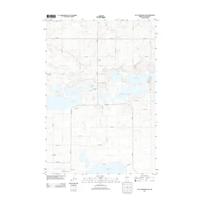
2013 Map of Little Kandiyohi Lake
USGS Topo · Published 2013About this map
Little Kandiyohi Lake and its neighboring basins define this aquatic landscape in central Minnesota, where a complex network of waterways facilitates local drainage. The area is marked by a series of interconnected lakes, including the expansive Lake Wakanda and Big Kandiyohi Lake, which are linked by the Big Kandiyohi Channel. Smaller bodies like Swan Lake and Lake Eleanor dot the terrain, while the S Fork Crow River and drainage features like County Ditch Number Twentythree A reveal the managed hydrology of the agricultural countryside.
Find a feature on this map
35 named features on this map. Tap any name to fly to it.
Don’t see what you’re looking for? This feature index may not catch every label — zoom into the map to look around manually.
Map Details
Editions of this 2013 Little Kandiyohi Lake Map
This is the sole edition of this map. No revisions or reprints were ever made.
Other maps of this area

1953 · New Ulm
USGS Topo · 1:250,000

1953 · Saint Cloud
USGS Topo · 1:250,000

1956 · Atwater
USGS Topo · 1:62,500

1957 · Saint Cloud
USGS Topo · 1:250,000

1957 · New Ulm
USGS Topo · 1:250,000

1957 · Olivia
USGS Topo · 1:62,500

1958 · New Ulm
USGS Topo · 1:250,000

1958 · Saint Cloud
USGS Topo · 1:250,000

1958 · Willmar
USGS Topo · 1:24,000

1958 · Solomon Lake
USGS Topo · 1:24,000