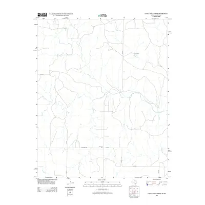
2012 Map of Little Wolf Creek
USGS Topo · Published 2012About this map
Needwood Cem and the surrounding ranchlands of Beckham County define this rural Oklahoma landscape as it appeared in the early 21st century. The map is dominated by an intricate drainage network of prairie creeks, with Wolf Cr and its tributary Little Wolf Cr winding through the southern and central sections. To the north, Lost Cr flows past the Lost Creek Ranch, illustrating the continued importance of livestock operations in this region. The section-line road grid remains the primary means of navigation, including routes such as Ranch Road 1439 and Co Rd 250. This survey offers a precise look at the rural infrastructure of the High Plains, where scattered homesteads and family cemeteries like Needwood remain the primary markers of human settlement amidst the sprawling drainage basins of Elm Cr and Wagon Cr.
Find a feature on this map
20 named features on this map. Tap any name to fly to it.
Don’t see what you’re looking for? This feature index may not catch every label — zoom into the map to look around manually.
Map Details
Editions of this 2012 Little Wolf Creek Map
This is the sole edition of this map. No revisions or reprints were ever made.
Other maps of this area

1954 · Amarillo
USGS Topo · 1:250,000

1954 · Plainview
USGS Topo · 1:250,000

1955 · Lawton
USGS Topo · 1:250,000

1955 · Clinton
USGS Topo · 1:250,000

1957 · Clinton
USGS Topo · 1:250,000

1958 · Amarillo
USGS Topo · 1:250,000

1958 · Plainview
USGS Topo · 1:250,000

1959 · Wellington NW
USGS Topo · 1:24,000

1959 · Shinnery Creek
USGS Topo · 1:24,000

1961 · Erick
USGS Topo · 1:62,500