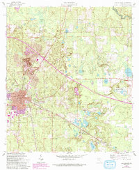
1961 Map of Live Oak East
USGS Topo · Published 1993About this map
Live Oak serves as the focal point for this north Florida region, showing significant urban development and industrial activity during the mid-20th century. The presence of the Suwannee Mine and an Old Railroad Grade indicates a landscape shaped by extraction and transportation. Outlying settlements such as Rixford, New Hope, and Houston are connected by a network of rural roads, while agricultural history is reflected in names like The Old Bulb Farm.
Find a feature on this map
43 named features on this map. Tap any name to fly to it.
Don’t see what you’re looking for? This feature index may not catch every label — zoom into the map to look around manually.
Map Details
Editions of this 1961 Live Oak East Map
2 editions found
Other maps of this area

1954 · Valdosta
USGS Topo · 1:250,000

1955 · Mayo NE
USGS Topo · 1:24,000

1958 · Valdosta
USGS Topo · 1:250,000

1958 · Fort Union
USGS Topo · 1:24,000

1959 · Valdosta
USGS Topo · 1:250,000

1959 · Live Oak West
USGS Topo · 1:24,000

1961 · Live Oak East
USGS Topo · 1:24,000

1961 · Hillcoat
USGS Topo · 1:24,000

1961 · White Springs West
USGS Topo · 1:24,000

1962 · Genoa
USGS Topo · 1:24,000