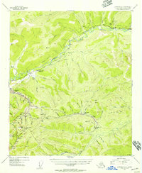
1954 Map of Livengood A-1
USGS Topo · Published 1956About this map
Chatanika River valley gold mining activity is the focal point of this mid-century survey, which details a landscape marked by industrial extraction and shifting settlements. The presence of extensive tailings and multiple specialized sites like the Cleary Hill Mine, Newsboy Mine (Aband), and McCarty Mine reveals the intense subsurface and hydraulic mining that shaped this interior terrain. While Chatanika serves as a primary hub along the Steese Highway, the map also documents several fading communities, including Cleary, Meehan, and Golden City (Abandoned). The topography is dominated by significant heights like Pedro Dome and Coffee Dome, providing the steep gradients necessary for the numerous creeks—such as Too Much Gold Cr and All Gold Creek—that fueled the local economy. Roadside infrastructure like the Cleary Summit Lodge and various isolated cabins indicate the era's reliance on the highway for logistics and shelter.
Find a feature on this map
71 named features on this map. Tap any name to fly to it.
Don’t see what you’re looking for? This feature index may not catch every label — zoom into the map to look around manually.
Map Details
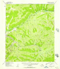
Editions of this 1954 Livengood A-1 Map
2 editions found
Other maps of this area

1945 · Livengood
USGS Topo · 1:250,000

1949 · Fairbanks D-1
USGS Topo · 1:62,500

1949 · Fairbanks D-2
USGS Topo · 1:62,500

1950 · Fairbanks
USGS Topo · 1:250,000

1950 · Big Delta
USGS Topo · 1:250,000

1950 · Big Delta D-6
USGS Topo · 1:63,360

1951 · Big Delta
USGS Topo · 1:250,000

1951 · Fairbanks
USGS Topo · 1:250,000

1951 · Livengood
USGS Topo · 1:250,000

1951 · Circle
USGS Topo · 1:250,000