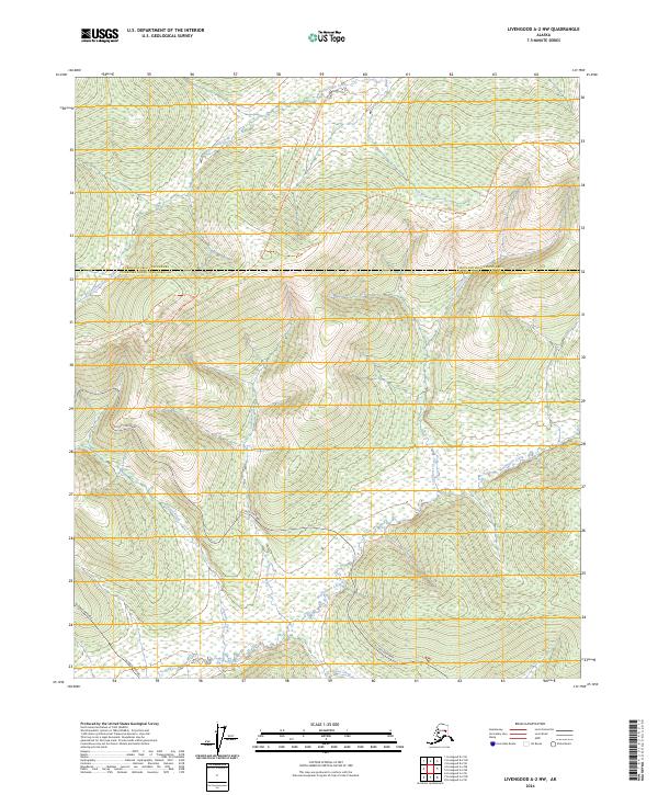
2024 Map of Livengood A-2 NW
USGS Topo · Published 2024About this map
The Alaska Pipeline cuts a distinct path through the southwestern portion of this Interior Alaska landscape, marking a vital industrial corridor through the Fairbanks North Star Borough. This modern survey illustrates the rugged drainage systems that define the region, including the headwaters and winding courses of Wickersham Creek, Washington Creek, and Cushman Creek. Large portions of the terrain fall within the White Mountains National Recreation Area, highlighting a wilderness managed for both conservation and public access.
Find a feature on this map
18 named features on this map. Tap any name to fly to it.
Don’t see what you’re looking for? This feature index may not catch every label — zoom into the map to look around manually.
Map Details
Editions of this 2024 Livengood A-2 NW Map
This is the sole edition of this map. No revisions or reprints were ever made.
Other maps of this area

1945 · Livengood
USGS Topo · 1:250,000

1951 · Livengood
USGS Topo · 1:250,000

1951 · Livengood B-2
USGS Topo · 1:63,360

1952 · Livengood A-2
USGS Topo · 1:63,360

1953 · Livengood A-3
USGS Topo · 1:63,360

1954 · Livengood B-3
USGS Topo · 1:63,360
1954 · Livengood B-2
USGS Topo · 1:63,360
1954 · Livengood A-2
USGS Topo · 1:63,360

1956 · Livengood
USGS Topo · 1:250,000

1964 · Livengood
USGS Topo · 1:250,000