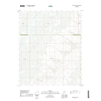
2017 Map of Livengood A-3 NW
USGS Topo · Published 2017About this map
Tatalina River meanders across this northern landscape, defining the transition between the low-lying interior wetlands and the rising uplands to the south. This 2017 survey documents a remote stretch of the Alaska interior where the Yukon-Koyukuk Census Area meets the Fairbanks North Star Borough boundary. The map illustrates a complex drainage network where Twin Cr joins the larger river system amidst a patchwork of marshes. In the southeastern corner, the terrain shifts significantly as the elevation climbs toward unnamed ridges, with Kugle Cr draining the higher slopes. This edition captures the precise topography of the Alaskan bush, highlighting the intricate waterway patterns that have long dictated movement and land use in the region.
Find a feature on this map
9 named features on this map. Tap any name to fly to it.
Don’t see what you’re looking for? This feature index may not catch every label — zoom into the map to look around manually.
Map Details
Editions of this 2017 Livengood A-3 NW Map
This is the sole edition of this map. No revisions or reprints were ever made.
Other maps of this area

1945 · Livengood
USGS Topo · 1:250,000

1951 · Livengood
USGS Topo · 1:250,000

1951 · Livengood A-4
USGS Topo · 1:63,360

1953 · Livengood B-4
USGS Topo · 1:63,360

1953 · Livengood A-4
USGS Topo · 1:63,360

1953 · Livengood A-3
USGS Topo · 1:63,360

1954 · Livengood B-3
USGS Topo · 1:63,360

1956 · Livengood
USGS Topo · 1:250,000

1964 · Livengood
USGS Topo · 1:250,000
2017 · Livengood A-3 NE
USGS Topo · 1:25,000