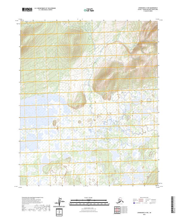
2024 Map of Livengood A-5 NE
USGS Topo · Published 2024About this map
Tolovana River meanders across the southern and central sections of this interior Alaskan landscape, defining the local drainage patterns near the t4n r8w and t4n r7w boundaries. The terrain is characterized by a high concentration of wetlands and small kettle lakes, typical of the Yukon-Koyukuk region. In the northern reaches, the elevation rises toward the headwaters of Montana Creek and Idaho Creek, where the land transitions from saturated lowlands to more defined ridges. This survey illustrates the intricate water systems of the Alaskan wilderness before significant road development, where the seasonal movement of water across the t5n r8w and t5n r7w townships dictates the character of the environment.
Find a feature on this map
7 named features on this map. Tap any name to fly to it.
Don’t see what you’re looking for? This feature index may not catch every label — zoom into the map to look around manually.
Map Details
Editions of this 2024 Livengood A-5 NE Map
This is the sole edition of this map. No revisions or reprints were ever made.
Other maps of this area

1945 · Livengood
USGS Topo · 1:250,000

1951 · Livengood
USGS Topo · 1:250,000

1951 · Livengood A-5
USGS Topo · 1:63,360

1951 · Livengood A-4
USGS Topo · 1:63,360

1952 · Livengood B-5
USGS Topo · 1:63,360

1953 · Livengood B-4
USGS Topo · 1:63,360

1953 · Livengood A-4
USGS Topo · 1:63,360
1954 · Livengood A-5
USGS Topo · 1:63,360

1956 · Livengood
USGS Topo · 1:250,000

1964 · Livengood
USGS Topo · 1:250,000