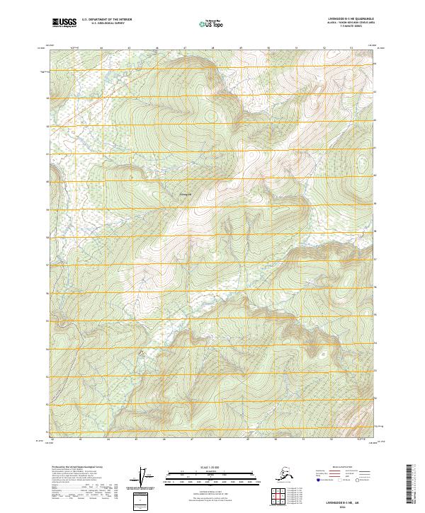
2024 Map of Livengood B-3 NE
USGS Topo · Published 2024About this map
Livengood serves as the central point of reference in this interior Alaska landscape, situated where the Elliott Highway traverses the northern reaches of the Yukon-Koyukuk region. The map illustrates a complex drainage system defined by the Tolovana River and the Tatalina River, which meander through the southern half of the quadrangle. High ground and tributary valleys are etched by waterways including Dominion Creek and O'Brien Creek, revealing the natural corridors that have shaped movement through this territory.
Find a feature on this map
15 named features on this map. Tap any name to fly to it.
Don’t see what you’re looking for? This feature index may not catch every label — zoom into the map to look around manually.
Map Details
Editions of this 2024 Livengood B-3 NE Map
This is the sole edition of this map. No revisions or reprints were ever made.
Other maps of this area

1945 · Livengood
USGS Topo · 1:250,000

1951 · Livengood
USGS Topo · 1:250,000

1951 · Livengood C-2
USGS Topo · 1:63,360

1951 · Livengood B-2
USGS Topo · 1:63,360

1954 · Livengood C-2
USGS Topo · 1:63,360

1954 · Livengood B-3
USGS Topo · 1:63,360
1954 · Livengood B-2
USGS Topo · 1:63,360
1954 · Livengood C-3
USGS Topo · 1:63,360

1956 · Livengood
USGS Topo · 1:250,000

1964 · Livengood
USGS Topo · 1:250,000