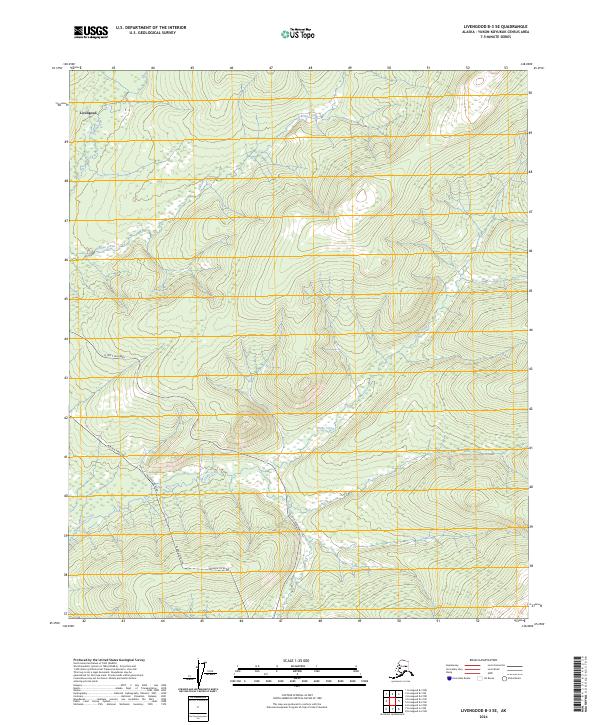
2024 Map of Livengood B-3 SE
USGS Topo · Published 2024About this map
Livengood stands as a focal point in this portion of the interior, situated near the headwaters of O'Brien Creek. The landscape is defined by the logistical corridor of the Alaska Pipeline and the Elliott Highway, which parallel one another as they traverse the drainage of Globe Creek. To the northeast, the terrain rises toward the White Mountains National Recreation Area, where the Summit Tr provides access to the higher elevations. This map illustrates the modern infrastructure necessary to navigate and manage the vast subarctic wilderness, showing the intersection of resource extraction history at the settlement and the critical energy transport systems that define the modern era.
Find a feature on this map
11 named features on this map. Tap any name to fly to it.
Don’t see what you’re looking for? This feature index may not catch every label — zoom into the map to look around manually.
Map Details
Editions of this 2024 Livengood B-3 SE Map
This is the sole edition of this map. No revisions or reprints were ever made.
Other maps of this area

1945 · Livengood
USGS Topo · 1:250,000

1951 · Livengood
USGS Topo · 1:250,000

1951 · Livengood B-2
USGS Topo · 1:63,360

1952 · Livengood A-2
USGS Topo · 1:63,360

1953 · Livengood A-3
USGS Topo · 1:63,360

1954 · Livengood B-3
USGS Topo · 1:63,360
1954 · Livengood B-2
USGS Topo · 1:63,360
1954 · Livengood A-2
USGS Topo · 1:63,360

1956 · Livengood
USGS Topo · 1:250,000

1964 · Livengood
USGS Topo · 1:250,000