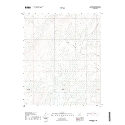
2017 Map of Livengood B-3 SW
USGS Topo · Published 2017About this map
Industrial infrastructure meets a network of interior waterways in this 2017 study of the Yukon-Koyukuk Census Area. The Alaska Pipeline dominates the central terrain, cutting a distinct path through the wilderness and across the Tatalina River. This modern engineering feat runs parallel to several drainage systems, reflecting the strategic coordination required for resource transport in this environment. In the northeast corner, the Elliott Highway provides the primary overland access to this section of the interior, following the high ground above O'Brien Cr. The landscape is defined by its hydrology, with Globe Cr and Slate Cr winding through the southern and western portions of the quadrangle. These names often indicate the region's mining history and mineral potential, marking a geography shaped by both natural flow and human transit.
Find a feature on this map
12 named features on this map. Tap any name to fly to it.
Don’t see what you’re looking for? This feature index may not catch every label — zoom into the map to look around manually.
Map Details
Editions of this 2017 Livengood B-3 SW Map
This is the sole edition of this map. No revisions or reprints were ever made.
Other maps of this area

1945 · Livengood
USGS Topo · 1:250,000

1951 · Livengood
USGS Topo · 1:250,000

1951 · Livengood A-4
USGS Topo · 1:63,360

1953 · Livengood B-4
USGS Topo · 1:63,360

1953 · Livengood A-4
USGS Topo · 1:63,360

1953 · Livengood A-3
USGS Topo · 1:63,360

1954 · Livengood B-3
USGS Topo · 1:63,360

1956 · Livengood
USGS Topo · 1:250,000

1964 · Livengood
USGS Topo · 1:250,000
2017 · Livengood A-3 NE
USGS Topo · 1:25,000