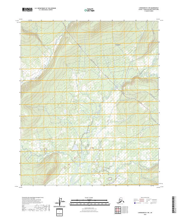
2024 Map of Livengood B-3 SW
USGS Topo · Published 2024About this map
Livengood serves as the central focal point in this interior Alaskan landscape, situated where the high-latitude terrain is defined by the winding course of the Tatalina River and its various tributaries. The map documents the critical infrastructure that traverses this remote region, most notably the Alaska Pipeline, which cuts a distinct path across the ridges and valleys. Transport and access are anchored by the Elliott Highway, which provides the primary corridor through the Yukon-Koyukuk Census Area.
Find a feature on this map
13 named features on this map. Tap any name to fly to it.
Don’t see what you’re looking for? This feature index may not catch every label — zoom into the map to look around manually.
Map Details
Editions of this 2024 Livengood B-3 SW Map
This is the sole edition of this map. No revisions or reprints were ever made.
Other maps of this area

1945 · Livengood
USGS Topo · 1:250,000

1951 · Livengood
USGS Topo · 1:250,000

1951 · Livengood A-4
USGS Topo · 1:63,360

1953 · Livengood B-4
USGS Topo · 1:63,360

1953 · Livengood A-4
USGS Topo · 1:63,360

1953 · Livengood A-3
USGS Topo · 1:63,360

1954 · Livengood B-3
USGS Topo · 1:63,360

1956 · Livengood
USGS Topo · 1:250,000

1964 · Livengood
USGS Topo · 1:250,000
2017 · Livengood A-3 NE
USGS Topo · 1:25,000