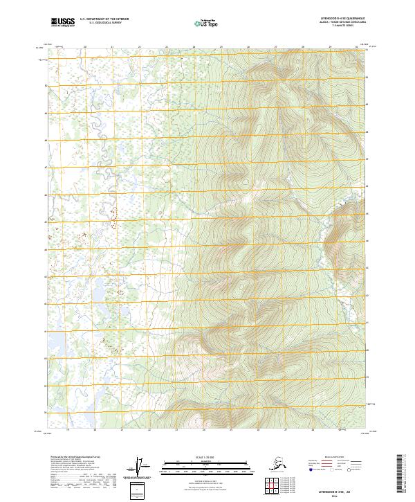
2024 Map of Livengood B-4 SE
USGS Topo · Published 2024About this map
The Tolovana River winds through the western half of this quadrangle, defining a complex landscape of wetlands and oxbows within the Yukon-Koyukuk region. This 2024 survey captures the intricate drainage patterns where smaller tributaries like Vigor Creek and Brooks Creek feed into the main river channel from the surrounding uplands. The terrain shifts from the low-lying river valley in the west to more pronounced relief in the east, where Slate Creek carves through the interior hills. The map illustrates the fundamental hydrological structure of the area, highlighting the transition between the saturated valley floor and the rising elevations of the eastern townships, providing a clear record of the natural watercourses that have historically dictated movement through this interior Alaskan wilderness.
Find a feature on this map
8 named features on this map. Tap any name to fly to it.
Don’t see what you’re looking for? This feature index may not catch every label — zoom into the map to look around manually.
Map Details
Editions of this 2024 Livengood B-4 SE Map
This is the sole edition of this map. No revisions or reprints were ever made.
Other maps of this area

1945 · Livengood
USGS Topo · 1:250,000

1951 · Livengood
USGS Topo · 1:250,000

1951 · Livengood A-4
USGS Topo · 1:63,360

1953 · Livengood B-4
USGS Topo · 1:63,360

1953 · Livengood A-4
USGS Topo · 1:63,360

1953 · Livengood A-3
USGS Topo · 1:63,360

1954 · Livengood B-3
USGS Topo · 1:63,360

1956 · Livengood
USGS Topo · 1:250,000

1964 · Livengood
USGS Topo · 1:250,000
2017 · Livengood B-4 SW
USGS Topo · 1:25,000