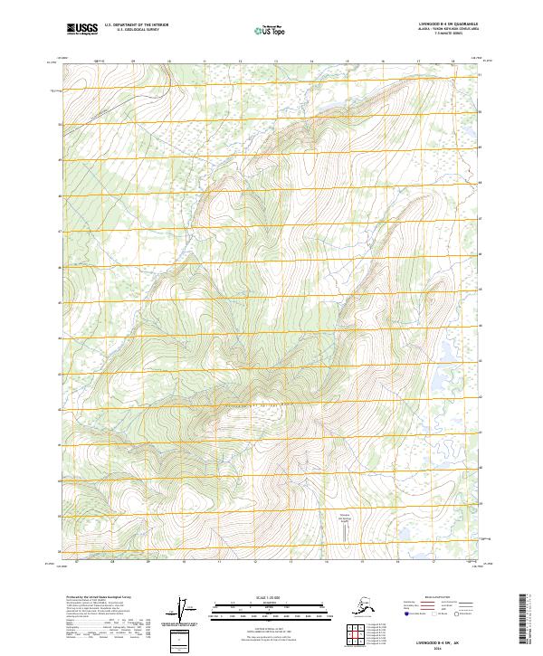
2024 Map of Livengood B-4 SW
USGS Topo · Published 2024About this map
Tolovana Hot Springs Dome dominates the central landscape of this interior Alaska region, marking a significant topographical rise north of the Tanana Valley. The area is defined by its thermal activity, centered around the Tolovana Hot Springs and additional Hot Springs found at the base of the dome's southern slopes. This remote pocket of the Yukon-Koyukuk Census Area remains accessible primarily by air via the Tolovana Hot Springs Airport or by following the rugged terrain surrounding the upper reaches of Brooks Creek.
Find a feature on this map
10 named features on this map. Tap any name to fly to it.
Don’t see what you’re looking for? This feature index may not catch every label — zoom into the map to look around manually.
Map Details
Editions of this 2024 Livengood B-4 SW Map
This is the sole edition of this map. No revisions or reprints were ever made.
Other maps of this area

1945 · Livengood
USGS Topo · 1:250,000

1951 · Livengood
USGS Topo · 1:250,000

1951 · Livengood A-5
USGS Topo · 1:63,360

1951 · Livengood A-4
USGS Topo · 1:63,360

1952 · Livengood B-5
USGS Topo · 1:63,360

1953 · Livengood B-4
USGS Topo · 1:63,360

1953 · Livengood A-4
USGS Topo · 1:63,360
1954 · Livengood A-5
USGS Topo · 1:63,360

1956 · Livengood
USGS Topo · 1:250,000

1964 · Livengood
USGS Topo · 1:250,000