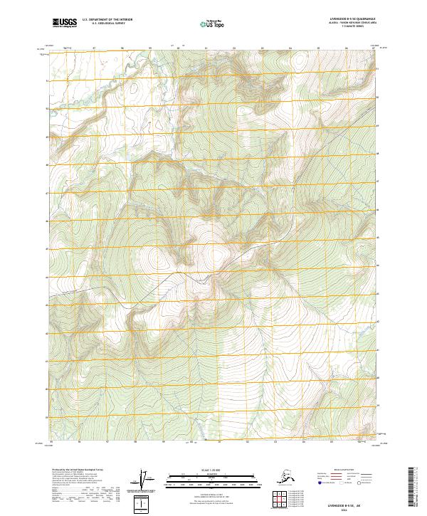
2024 Map of Livengood B-5 SE
USGS Topo · Published 2024About this map
The Elliott Highway cuts a winding path through the high interior of the Yukon-Koyukuk Census Area, serving as the primary corridor for movement across this drainage-dense landscape. This 2024 survey captures the headwaters and tributaries of several significant waterways, including the West Fork Tolovana River which dominates the northwest corner of the quadrangle. To the south and east, the terrain is defined by the steep valleys of Montana Creek, Brooks Creek, and Idaho Creek. The map provides a contemporary record of the public land survey system divisions, specifically marking the meeting of Townships 5 and 6 North and Ranges 7 and 8 West. This data reflects the ongoing management of the Alaskan interior where the road network must navigate significant elevation changes between established creek beds.
Find a feature on this map
9 named features on this map. Tap any name to fly to it.
Don’t see what you’re looking for? This feature index may not catch every label — zoom into the map to look around manually.
Map Details
Editions of this 2024 Livengood B-5 SE Map
This is the sole edition of this map. No revisions or reprints were ever made.
Other maps of this area

1945 · Livengood
USGS Topo · 1:250,000

1951 · Livengood
USGS Topo · 1:250,000

1951 · Livengood A-5
USGS Topo · 1:63,360

1951 · Livengood A-4
USGS Topo · 1:63,360

1952 · Livengood B-5
USGS Topo · 1:63,360

1953 · Livengood B-4
USGS Topo · 1:63,360

1953 · Livengood A-4
USGS Topo · 1:63,360
1954 · Livengood A-5
USGS Topo · 1:63,360

1956 · Livengood
USGS Topo · 1:250,000

1964 · Livengood
USGS Topo · 1:250,000