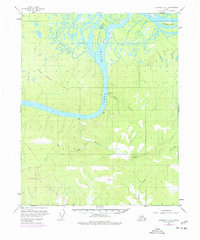
1952 Map of Livengood D-5
USGS Topo · Published 1977About this map
The Yukon River carves a massive path through this Interior Alaska landscape, flanked by the Fort Hamlin Hills to the north and a network of drainages to the south. This 1952 topographic survey, updated in the mid-1970s, documents a significant moment of industrial change with the presence of The Trans-Alaska Pipeline shown as under construction in the southwest corner. The river itself is dominated by large landforms such as Chetlechak Island and Theodore Island, while the Little Dall River feeds into the main channel from the northwest.
Find a feature on this map
18 named features on this map. Tap any name to fly to it.
Don’t see what you’re looking for? This feature index may not catch every label — zoom into the map to look around manually.
Map Details
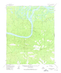
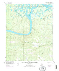
Editions of this 1952 Livengood D-5 Map
4 editions found
Other maps of this area

1945 · Livengood
USGS Topo · 1:250,000

1951 · Livengood
USGS Topo · 1:250,000

1951 · Beaver
USGS Topo · 1:250,000

1952 · Livengood C-5
USGS Topo · 1:63,360

1952 · Livengood D-5
USGS Topo · 1:63,360

1952 · Livengood C-4
USGS Topo · 1:63,360

1953 · Livengood D-4
USGS Topo · 1:63,360

1954 · Livengood D-4
USGS Topo · 1:63,360

1954 · Livengood C-4
USGS Topo · 1:63,360

1956 · Beaver A-5
USGS Topo · 1:63,360