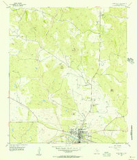
1955 Map of Llano North
USGS Topo · Published 1956About this map
The Llano River and its impoundment at Llano City Lake anchor the southern edge of this mid-century survey, where the town of Llano serves as a hub for the surrounding hill country. North of the river, the landscape rises toward distinctive peaks like Horse Mountain and Fox Mountain, drained by a network of seasonal streams including Pecan Creek and Wrights Creek. These creek valleys harbor small community centers such as Mayes Chapel, where the Mayes Chapel Cem and Wrights Creek Cem provide essential data for genealogical research.
Find a feature on this map
33 named features on this map. Tap any name to fly to it.
Don’t see what you’re looking for? This feature index may not catch every label — zoom into the map to look around manually.
Map Details
Editions of this 1955 Llano North Map
2 editions found
Other maps of this area

1887 · Llano
USGS Topo · 1:125,000

1894 · Llano
USGS Topo · 1:125,000

1904 · Llano
USGS Topo · 1:125,000

1909 · Llano
USGS Topo · 1:125,000

1918 · Llano
USGS Topo · 1:125,000

1954 · Llano
USGS Topo · 1:250,000

1955 · Llano
USGS Topo · 1:250,000
1955 · Magill Mountain
USGS Topo · 1:24,000

1955 · Valley Spring
USGS Topo · 1:24,000
1955 · Valley Spring
USGS Topo · 1:62,500