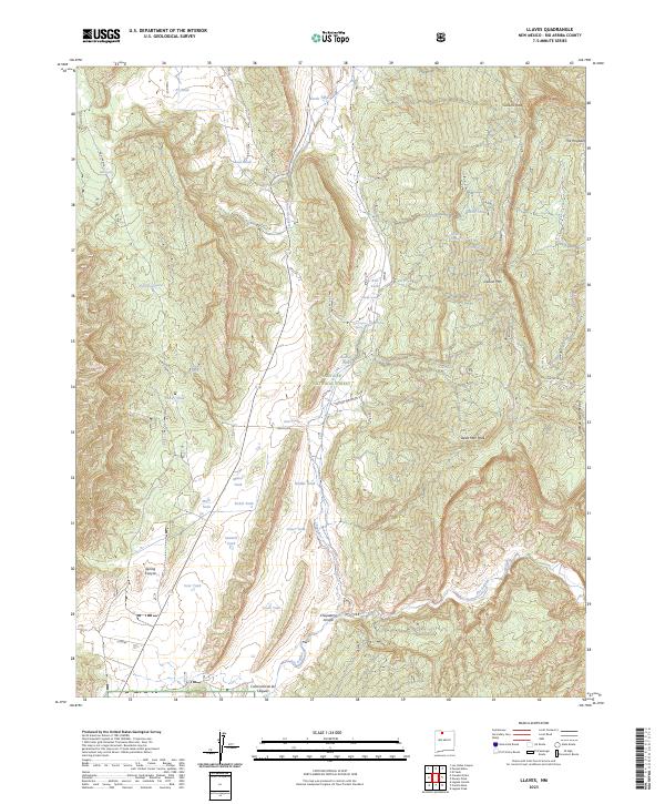
2023 Map of Llaves
USGS Topo · Published 2023About this map
Santa Fe National Forest and the Chama River Canyon Wilderness dominate this high-elevation landscape in Rio Arriba County. The terrain is defined by dramatic vertical relief, notably the soaring heights of Gallina Peak and Dead Man Peak. The northern reaches of the Rio Gallina wind through the eastern canyons, while the water management of this arid environment is evident in the numerous tanks scattered across the topography, including Sawmill Tank and Alamo Tank.
Find a feature on this map
44 named features on this map. Tap any name to fly to it.
Don’t see what you’re looking for? This feature index may not catch every label — zoom into the map to look around manually.
Map Details
Editions of this 2023 Llaves Map
This is the sole edition of this map. No revisions or reprints were ever made.
Other maps of this area

1909 · Gallina
USGS Topo · 1:125,000

1953 · Laguna Peak
USGS Topo · 1:24,000

1953 · Navajo Peak
USGS Topo · 1:24,000

1954 · Aztec
USGS Topo · 1:250,000

1955 · Llaves
USGS Topo · 1:62,500

1955 · Tierra Amarilla
USGS Topo · 1:62,500

1955 · Boulder Lake
USGS Topo · 1:62,500

1958 · Aztec
USGS Topo · 1:250,000

1962 · Aztec
USGS Topo · 1:250,000

1965 · Aztec
USGS Topo · 1:250,000