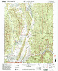
2002 Map of Llaves
USGS Topo · Published 2003About this map
Gallina Peak and the high ridges of Gallina Mountain dominate this landscape on the edge of the Santa Fe National Forest. The 2002 revision shows a region defined by its rugged drainages and vital water sources, with numerous tanks such as Moscoso Tank and Casa Tank supporting land use in this arid environment. The small community of Llaves is situated in the southwest near Cañoncito de las Lleguas, providing a glimpse into the isolated ranching and residential patterns of Rio Arriba County.
Find a feature on this map
49 named features on this map. Tap any name to fly to it.
Don’t see what you’re looking for? This feature index may not catch every label — zoom into the map to look around manually.
Map Details
Editions of this 2002 Llaves Map
This is the sole edition of this map. No revisions or reprints were ever made.
Other maps of this area

1909 · Gallina
USGS Topo · 1:125,000

1953 · Laguna Peak
USGS Topo · 1:24,000

1953 · Navajo Peak
USGS Topo · 1:24,000

1954 · Aztec
USGS Topo · 1:250,000

1955 · Llaves
USGS Topo · 1:62,500

1955 · Tierra Amarilla
USGS Topo · 1:62,500

1955 · Boulder Lake
USGS Topo · 1:62,500

1958 · Aztec
USGS Topo · 1:250,000

1962 · Aztec
USGS Topo · 1:250,000

1965 · Aztec
USGS Topo · 1:250,000