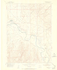
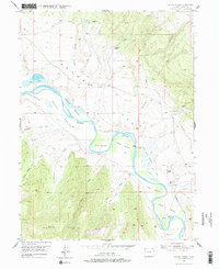
1954 Map of Lodore School
USGS Topo · Published 1955About this map
The Green River meanders through a series of fertile floodplains known as bottoms in this mid-century survey of northwestern Colorado. The landscape of Browns Park is defined by a distinct ranching and homesteading heritage, where life centered on the water and the river-carved flats such as Warren Bottom and Nelson Bottom. The presence of the Lodore Sch near the Two Bar Ranch indicates a once-active rural community, while numerous sites like Spitzie Place (Aband) and Sterling Place (Aband) suggest a shift in settlement patterns by the 1950s.
Find a feature on this map
33 named features on this map. Tap any name to fly to it.
Don’t see what you’re looking for? This feature index may not catch every label — zoom into the map to look around manually.
Map Details
Editions of this 1954 Lodore School Map
6 editions found
Other maps of this area

1885 · Ashley
USGS Topo · 1:250,000

1952 · Willow Creek Butte
USGS Topo · 1:24,000

1952 · Swallow Canyon
USGS Topo · 1:24,000

1954 · Lodore School
USGS Topo · 1:24,000

1954 · Canyon of Lodore North
USGS Topo · 1:24,000

1954 · Vernal
USGS Topo · 1:250,000

1958 · Vernal
USGS Topo · 1:250,000

1960 · Vernal
USGS Topo · 1:250,000
1966 · Beaver Basin
USGS Topo · 1:24,000

1966 · Big Joe Basin
USGS Topo · 1:24,000