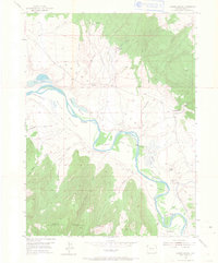
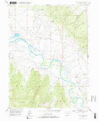
1954 Map of Lodore School
USGS Topo · Published 1967About this map
Browns Park unfolds along the winding corridor of the Green River in this 1954 field-checked survey of Moffat County. The landscape is characterized by its expansive river bottoms, including Flynn Bottom, Warren Bottom, and J S Hoy Bottom, which supported a series of isolated homesteads and ranching operations. The presence of the Lodore Sch and the Two Bar Ranch indicates a settled but sparse rural community tied to the river's path.
Find a feature on this map
33 named features on this map. Tap any name to fly to it.
Don’t see what you’re looking for? This feature index may not catch every label — zoom into the map to look around manually.
Map Details
Editions of this 1954 Lodore School Map
6 editions found
Other maps of this area

1885 · Ashley
USGS Topo · 1:250,000

1952 · Willow Creek Butte
USGS Topo · 1:24,000

1952 · Swallow Canyon
USGS Topo · 1:24,000

1954 · Lodore School
USGS Topo · 1:24,000

1954 · Canyon of Lodore North
USGS Topo · 1:24,000

1954 · Vernal
USGS Topo · 1:250,000

1958 · Vernal
USGS Topo · 1:250,000

1960 · Vernal
USGS Topo · 1:250,000
1966 · Beaver Basin
USGS Topo · 1:24,000

1966 · Big Joe Basin
USGS Topo · 1:24,000