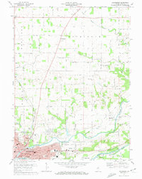
1972 Map of Logansport
USGS Topo · Published 1974About this map
Logansport serves as the focal point of this 1970s landscape, situated at the confluence of the Eel River and the Wabash River. The city's industrial and civic core is well-defined, featuring the Penn Central and Norfolk and Western railroads, a Powerplant, and Memorial Hosp. To the north and east, the map reveals a meticulously surveyed grid of township roads intersecting the Old Treaty Boundary, which cuts diagonally across the terrain near Metea.
Find a feature on this map
107 named features on this map. Tap any name to fly to it.
Don’t see what you’re looking for? This feature index may not catch every label — zoom into the map to look around manually.
Map Details
Editions of this 1972 Logansport Map
2 editions found
Other maps of this area

1951 · Onward
USGS Topo · 1:24,000

1951 · Twelve Mile
USGS Topo · 1:24,000

1953 · Danville
USGS Topo · 1:250,000

1955 · Danville
USGS Topo · 1:250,000

1955 · Logansport
USGS Topo · 1:24,000

1955 · Anoka
USGS Topo · 1:24,000

1956 · Danville
USGS Topo · 1:250,000

1960 · Lucerne
USGS Topo · 1:24,000

1960 · Fulton
USGS Topo · 1:24,000

1960 · Macy
USGS Topo · 1:24,000