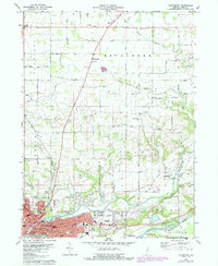
1972 Map of Logansport
USGS Topo · Published 1987About this map
Logansport serves as the focal point of this survey, situated at the significant confluence where the Eel River meets the Wabash River. The mid-20th-century landscape reveals a dense urban core featuring the Courthouse, City Hall, and several parochial institutions like St Josephs Sch and St Vincents Sch. Outside the city, the terrain is divided by historical surveying lines, most notably the Treaty Boundary that cuts across the northern townships of Bethlehem and Miami. Transportation patterns are defined by the Norfolk and Western railroad and an Old Railroad Grade near Adamsboro. Small rural hubs like Metea and Mt Pleasant anchor the northern reaches, while numerous family and community burial sites, including Bethel Cem and Horney Cem, provide essential data for genealogical research into the area's early residents.
Find a feature on this map
61 named features on this map. Tap any name to fly to it.
Don’t see what you’re looking for? This feature index may not catch every label — zoom into the map to look around manually.
Map Details
Editions of this 1972 Logansport Map
2 editions found
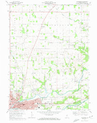
Other maps of this area

1951 · Onward
USGS Topo · 1:24,000

1951 · Twelve Mile
USGS Topo · 1:24,000

1953 · Danville
USGS Topo · 1:250,000

1955 · Danville
USGS Topo · 1:250,000

1955 · Logansport
USGS Topo · 1:24,000

1955 · Anoka
USGS Topo · 1:24,000

1956 · Danville
USGS Topo · 1:250,000

1960 · Lucerne
USGS Topo · 1:24,000

1960 · Fulton
USGS Topo · 1:24,000

1960 · Macy
USGS Topo · 1:24,000