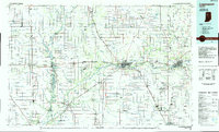
1985 Map of Logansport
USGS Topo · Published 1985About this map
The Tippecanoe River meanders through the heart of north-central Indiana, defining the geography of Monticello and East Monticello. In the mid-1980s, this region was characterized by its dense network of drainage canals, including Pelsey Ditch and Big Monon Ditch, which supported the productive agricultural landscape surrounding towns like Francesville and Star City. The presence of Lake Shafer and recreation areas such as Lower Sunset Park and Roth Park highlights the importance of the river system for both utility and leisure.
Find a feature on this map
211 named features on this map. Tap any name to fly to it.
Don’t see what you’re looking for? This feature index may not catch every label — zoom into the map to look around manually.
Map Details
Editions of this 1985 Logansport Map
2 editions found
Other maps of this area

1941 · Lafayette
USGS Topo · 1:24,000

1942 · Otterbein
USGS Topo · 1:24,000

1942 · Lafayette
USGS Topo · 1:24,000

1950 · Lafayette
USGS Topo · 1:24,000

1951 · Peru
USGS Topo · 1:24,000

1951 · Onward
USGS Topo · 1:24,000

1951 · Twelve Mile
USGS Topo · 1:24,000

1951 · Bunker Hill
USGS Topo · 1:24,000

1951 · Otterbein
USGS Topo · 1:24,000

1951 · Richvalley
USGS Topo · 1:24,000