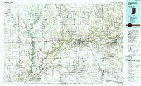
1985 Map of Logansport
USGS Topo · Published 1994About this map
The Tippecanoe River winds through this central Indiana landscape, anchoring a network of small towns and agricultural lands during the mid-1980s. Significant transportation and military infrastructure define the region, most notably the expansive Grissom Air Force Base in the southeast and a dense web of rail lines including the Chesapeake and Ohio RR, Norfolk and Western RR, and Conrail. The map captures the industrial and civic heart of the area, featuring the State Hospital and Logansport Municipal Airport near the confluence of local transit routes.
Find a feature on this map
212 named features on this map. Tap any name to fly to it.
Don’t see what you’re looking for? This feature index may not catch every label — zoom into the map to look around manually.
Map Details
Editions of this 1985 Logansport Map
2 editions found
Other maps of this area

1941 · Lafayette
USGS Topo · 1:24,000

1942 · Otterbein
USGS Topo · 1:24,000

1942 · Lafayette
USGS Topo · 1:24,000

1950 · Lafayette
USGS Topo · 1:24,000

1951 · Peru
USGS Topo · 1:24,000

1951 · Onward
USGS Topo · 1:24,000

1951 · Twelve Mile
USGS Topo · 1:24,000

1951 · Bunker Hill
USGS Topo · 1:24,000

1951 · Otterbein
USGS Topo · 1:24,000

1951 · Richvalley
USGS Topo · 1:24,000