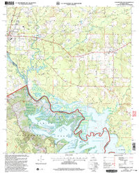
2003 Map of Logansport East
USGS Topo · Published 2004About this map
Logansport anchors this landscape where the Sabine River forms the state line between Louisiana and Texas. The 2003 revision reveals a region defined by its timber and water resources, with the Sabine National Forest occupying the southern reaches and the sprawling fingers of the Toledo Bend Reservoir beginning to inundate the low-lying creek valleys. The settlement pattern is deeply rooted in local history, evidenced by small rural churches and family-named burying grounds like Price Cem, Smith Cem, and the Mt Olivet Ch Cem. The transition from old river bottoms like Cane Bottom to the upland forests of Southerland illustrates the changing land use at the turn of the 21st century, where industrial oil and gas infrastructure exists alongside traditional rural communities like Stanley.
Find a feature on this map
37 named features on this map. Tap any name to fly to it.
Don’t see what you’re looking for? This feature index may not catch every label — zoom into the map to look around manually.
Map Details
Editions of this 2003 Logansport East Map
This is the sole edition of this map. No revisions or reprints were ever made.
Other maps of this area

1944 · Logansport
USGS Topo · 1:62,500

1945 · Grand Cane
USGS Topo · 1:62,500

1945 · Socagee Bayou
USGS Topo · 1:62,500

1953 · Alexandria
USGS Topo · 1:250,000

1953 · Palestine
USGS Topo · 1:250,000

1955 · Shreveport
USGS Topo · 1:250,000

1955 · Alexandria
USGS Topo · 1:250,000

1956 · Shreveport
USGS Topo · 1:250,000

1956 · Tyler
USGS Topo · 1:250,000

1956 · Logansport
USGS Topo · 1:62,500