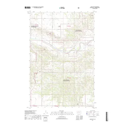
2017 Map of Lone Butte
USGS Topo · Published 2017About this map
The Little Missouri River meanders across this Badlands landscape, carving a deep valley that defines the local topography. This 2017 survey shows a region largely preserved within the Little Missouri National Grassland and the northern edge of Theodore Roosevelt National Park. The terrain is punctuated by significant elevations such as Lone Butte, Morman Butte, and the distinctively flat-topped Square Top. Local drainages including Rough Cr, Spring Cr, and Dry Cr feed into the main river system, illustrating the complex erosional patterns of McKenzie County. The sparse road network, consisting of routes like Long X Rd and Co Rd 34, follows the high ridges and valley floors, providing access to these protected public lands and isolated grazing allotments.
Find a feature on this map
24 named features on this map. Tap any name to fly to it.
Don’t see what you’re looking for? This feature index may not catch every label — zoom into the map to look around manually.
Map Details
Editions of this 2017 Lone Butte Map
This is the sole edition of this map. No revisions or reprints were ever made.
Other maps of this area

1953 · Watford City
USGS Topo · 1:250,000

1957 · Watford City
USGS Topo · 1:250,000

1958 · Long X Divide
USGS Topo · 1:24,000

1958 · Lone Butte SE
USGS Topo · 1:24,000

1958 · Lone Butte
USGS Topo · 1:24,000

1958 · Tepee Buttes
USGS Topo · 1:24,000

1959 · Lone Butte NW
USGS Topo · 1:24,000

1959 · Lone Butte NE
USGS Topo · 1:24,000

1967 · Watford City
USGS Topo · 1:250,000

1974 · Petes Creek
USGS Topo · 1:24,000